Among numerous findings throughout the years, researchers have stumbled upon certain discoveries that, some say, should have never been made. Some of these discoveries directly contradict the beliefs and ‘tales’ set forth by mainstream scholars about mankind, its origins, and ancient civilizations that inhabited our planet in the distant past.It has become a widespread belief that ancient civilizations across the globe were much more advanced than what mainstream researchers are crediting them for. When I say advanced, I don’t necessarily have to turn to aliens and alien visitations. By now, we surely have understood that our ancestors were more than capable of achieving incredible things.Numerous maps discovered throughout the years are a clear indicator that the story told today by scholars is incomplete, and there are numerous missing links in our history.inks’ are being put together by these ancient maps, some of which may even prove how mankind populated our planet much longer than what mainstream scholars believe.Some would say that these ‘missing lThe existence of these maps hints that in the distant past, ancient explorers had an extremely well-developed cartography system comparable in precision with the one we have today.The maps are also evidence that ancient mankind knew the exact shape and size of the Earth,contrary to popular beliefs, and used spherical trigonometry, and precise and elaborate mathematical calculations, as if thousands of years ago, an unknown civilization undertook a global-scale project of mappingthe entire planet like no one has ever done before.
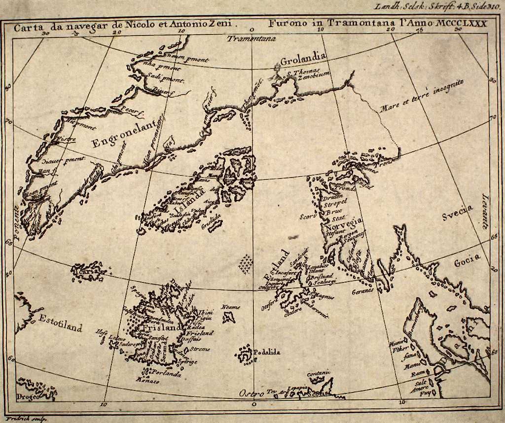
A reproduction of the Zeno map from a 1793 book. Source: Wikimedia Commons.
One of the most intriguing maps is the Zeno Map. Published around 1380, the enigmatic maps accurately depicts the coasts of modern-day countries such as Norway, Sweden, Denmark, Germany, and Scotland. Mysteriously, this ancient map also depicts the EXACT latitude and longitude of a number of islands on our planet. This is a huge enigma since the device necessary to measure the longitude, the chronometer, was not invented until 1765. If this isn’t mysterious enough, the Zeno map also depicts Greenland free of glaciers, meaning that somehow, someone charted it prior to the Ice Age.
The Camerio map. Created in 1502, this map does not depict unusual features as other maps do, but it has one very strange detail. The Camerio map uses a spherical grid, even though people in the middle ages still believed our planet was, in fact, flat.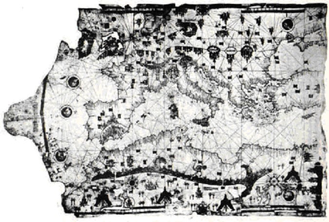 Map of Ibn Ben Zara (1487) Image Credit: Wikimedia Commons
Another mind-boggling map is without a doubt the Iehudi Ibn ben Zara map. Created in 1487, the map displays remnants of glaciers in Britain, but also extremely detailed depictions of islands in the Mediterranean and Aegean seas. Today, these islands still exist, but due to rising water levels, these are now underwater.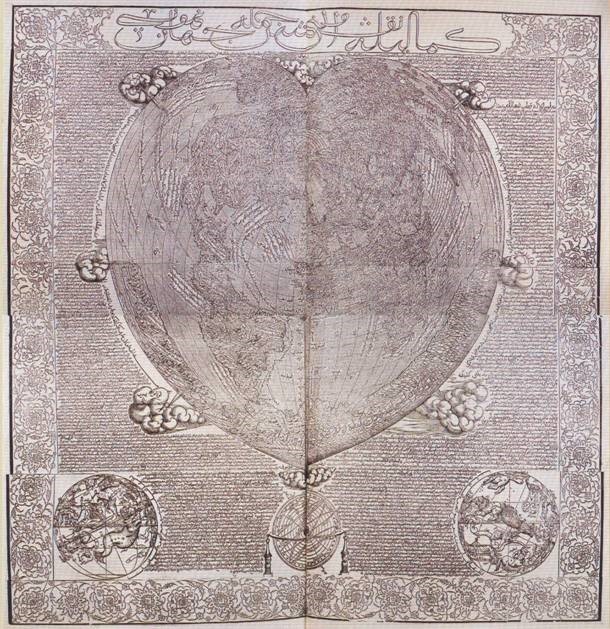 Hacı Ahmet’s Map of the World: A complete and perfect map describing the whole world Image Credit: Wikimedia Commons
The Hadji Ahmed map, published in 1559, shows incredibly accurate delineations of the western coast of Northern America and Antarctica. What is even more incredible is the fact that this ancient map shows a land bridge connection Siberia and Alaska, indicating it originated from a time when the bridge was still present.
Published in 1737 by Philippe Buache, theBuache map is believed to have been created with the use of much more ancient maps. This chart displays Antarctica well before the ‘icy’ continent was, in fact, discovered. Interestingly, like many other ancient maps, this too accurately depicts Antarctica with no ice. The Bouche Map also accurately positioned Canary Island.
The map published in 1737 also displays the correct outline of the underwater plateau on which the islands are located. This means that the source of the map used to create it is based on a survey of the shape before glaciers melted and ocean levels rose. Even more interesting is the fact that the Buache Map depicts the waterway, which divides the continent of Antarctica into two landmasses.
Created in 1502, the Harry King Chart displays northern Siberian rivers emptying into the Arctic ocean, which is now under the ice.
Interestingly, it also depicts glacial remains in the Baltic countries and accurately depicts the ancient Suez Canal. This incredible map also depicts what today are huge islands in Southeastern parts of Asia, but joined together by land, indicating that geologically speaking, the maps were created when the Earth looked much differently.
The Map of the North by Ptolemy depicts glacial sheets moving across south-central Greenland. It also depicts glaciers retreating from modern-day Germany (north) and parts of southern Sweden. Another map indicating a different timeline on Earth.
Another interesting map is the King Jaime World Chart. It was created in 1502, and accurately depicts parts of the Sahara Desert displaying it much differently than it is today: with fertile land, huge lakes rivers and what appear to be ancient cities. In fact, Sahara was, in the distant past, a fertile land filled with animal life and forests.
The Oronce Finé World Map created in 1534, is an early cordiform chart which displays features of Antarctica when the continent was not covered by Ice. While it is yet another map that shows the continent before it was officially ‘found,’ the chart also shows continent rivers, valleys, and coastlines while also depicting the approximate location of what is the South Pole today.
Printre numeroasele descoperiri de-a lungul anilor, cercetătorii s-au împiedicat de anumite descoperiri care, spun unii, nu ar fi trebuit să fie făcute niciodată. Unele dintre aceste descoperiri contrazic în mod direct credințele și „poveștile” expuse de savanți despre omenire, originile sale și civilizațiile antice care au locuit pe planeta noastră în trecutul îndepărtat. A devenit o credință larg răspândită că civilizațiile antice de pe glob erau mult mai mai avansate față de cum au fost creditate. Când spun avansat, nu trebuie neapărat să apelez la străini și vizite de extratereștri. Până acum, cu siguranță am înțeles că strămoșii noștri erau mai mult decât capabili să realizeze lucruri incredibile. Numeroase hărți descoperite de-a lungul anilor sunt un indicator clar că povestea spusă astăzi de savanți este incompletă și există numeroase legături lipsă în istoria noastră. „sunt alcătuite aceste hărți antice, unele dintre ele putând chiar demonstra modul în care omenirea a populat planeta noastră mult mai mult decât ceea ce cred savanții. Unii ar spune că aceste„ lipsește existența acestor hărți indică faptul că în trecutul îndepărtat, exploratorii antici avea un sistem de cartografie extrem de bine dezvoltat, comparabil în precizie cu cel pe care îl avem astăzi. Hărțile sunt, de asemenea, dovezi că omenirea antică știa forma și dimensiunea exactă a Pământului, contrar credințelor populare și a folosit trigonometria sferică și precisă și elaborate calcule matematice, ca și cum în urmă cu mii de ani, o civilizație necunoscută a întreprins un proiect la scară globală de cartografiere a întregii planete.
Una dintre cele mai interesante hărți este Zeno Map. Publicate în jurul anului 1380, hărțile enigmatice prezintă cu exactitate țărmurile țărilor moderne, precum Norvegia, Suedia, Danemarca, Germania și Scoția. În mod misterios, această hartă străveche prezintă, de asemenea, latitudinea și longitudinea exactă a mai multor insule de pe planeta noastră. Aceasta este o enigmă uriașă, deoarece dispozitivul necesar pentru a măsura longitudinea, sextantul, nu a fost inventat până în 1765. Dacă acest lucru nu este suficient de misterios, harta Zeno înfățișează și Groenlanda lipsită de ghețari, ceea ce înseamnă că, într-un fel, cineva a cartografiat-o înainte epoca de gheață.
Harta Camerio. Creată în 1502, această hartă nu prezintă caracteristici neobișnuite așa cum fac alte hărți, dar are un detaliu foarte ciudat. Harta Camerio folosește o grilă sferică, chiar dacă oamenii din Evul Mediu încă credeau că planeta noastră era, de fapt, plană.
O altă hartă extraordinară este, fără îndoială, harta Iehudi Ibn ben Zara. Creată în 1487, harta afișează rămășițe ale ghețarilor din Marea Britanie, dar și reprezentări extrem de detaliate ale insulelor din Marea Mediterană și din Marea Egee. Astăzi, aceste insule există încă, dar, din cauza creșterii nivelului apei, acestea sunt acum sub apă.
Harta Hadji Ahmed, publicată în 1559, arată delimitări incredibil de precise ale coastei de vest a Americii de Nord și a Antarcticii. Ceea ce este și mai incredibil este faptul că această hartă antică arată o legătură a podului terestru Siberia și Alaska, ceea ce indică faptul că provine dintr-o perioadă în care legătura era încă prezentă.
Publicată în 1737 de Philippe Buache, se consideră că harta Buache a fost creată cu ajutorul hărților mult mai vechi. Acest grafic afișează Antarctica cu mult înainte ca continentul „înghețat” să fie descoperit, de fapt. Interesant este ca în cazul multor alte hărți antice, aceasta prezintă prea precis Antarctica fără gheață. Harta Bouche a poziționat cu precizie și Insula Canare.
Harta publicată în 1737 afișează, de asemenea, conturul corect al platoului subacvatic pe care se află insulele. Acest lucru înseamnă că sursa hărții utilizate pentru crearea ei se bazează pe un sondaj al formei înainte de topirea ghețarilor și creșterea nivelului oceanelor. Și mai interesant este faptul că Harta Buache înfățișează calea navigabilă, care împarte continentul Antarcticii în două terenuri.
Creat în 1502, graficul Harry King afișează râurile din nordul Siberiei care se golesc în oceanul Arctic, care este acum sub gheață.
Este interesant faptul că prezintă și resturi glaciare din țările baltice și înfățișează cu exactitate vechiul Canal Suez. Această hartă incredibilă prezintă, de asemenea, ceea ce astăzi sunt insule uriașe în părțile de sud-est ale Asiei, dar unite între ele, ceea ce indică faptul că geologic vorbind, hărțile au fost create atunci când Pământul arăta mult diferit.
